Lost with Mike
  • Scoot
  • Paddle
  • Pedal
  • Moto
    • The South >
      • Merchant's Millpond State Park, NC
      • BRP and a visit to Charlotte, NC
      • South Carolina and Back on my GS (2011)
      • Jaw-ja Trip #1 - Visiting my Nephew
      • Jaw-ja Trip #2 - Cousin's Wedding
      • "You rode 1300 miles for BBQ?!?" (2010)
    • Canada (eh) >
      • 2012 - Beards to Canada >
        • Day 1: Arlington, VA > Arlington, VT
        • Day 1-2 (Continued) Back to VA!!!
        • Day 3: Newburyport, NH > Sandy Cove, NS
        • Day 4: Loafing around "The Neck"
        • Day 5: Sandy Cove, NS to Antigonish, NS
        • Day 6: Antigonish, NS to Meat Cove, NS
        • Day 7: Meat Cove, NS to Port Aux Basques, NFL
        • Day 8: Port Aux Basques to Port Saunders
        • Day 9: Port Saunders to Big Brook
        • Day 10: Big Brook, NL to Trans Lab Hwy
        • Day 11: Trans Lab Hwy to Pinware River
        • Day 12: Pinware River, LAB to Norris Point, NL
        • Day 13: Norris Point to Blue Beach
        • Day 14: Blue Beach, NL to Port Aux Basques Ferry
        • Day 15: Sydney, NS to Sandy Cove, NS
        • Day 16: Chillin on the Digby Neck
        • Day 17: Sandy Cove, NS to No. Sandwich, NH
        • Day 18: Sandiwch, NH to Arlington, VA (Home)
      • Algonquin Park 2013 >
        • Day 1: Home to New York
        • Day 2: Chataugay State Forest to Brent, ON
        • Day 3: Brent, ON to Nipissing River Portage at Nadine Lake
        • Day 4: Nipissing River @ Nadine Lake Portage to first island in Red Pine Bay
        • Day 5: Red Pine Bay to Hogan’s Lake
        • Day 6: Hogan’s Lake to Catfish Lake
        • Day 7: Catfish Lake to Cedar Lake to Fredonia, NY
        • Day 8: Fredonia, NY to Brookville, PA
        • Day 9: Brookville, PA to Alexandria, VA
      • Think I'll ride to Montreal this weekend...
      • Ontario on a Whim
    • Maryland >
      • How to Hit a Tree, By ME!
      • Ruckus Stealth Camping in MD
      • Ruck'n around Southern MD
      • White's Ferry and some Maryland Backroads
      • 1000mi right near da' beach (2010)
    • New York >
      • Cornell, Niagara Falls and PA Coal Country (2012)
      • Finger Lakes trip to NY (2011)
      • New York City Trip (2011)
    • Pennsylvania >
      • Early Spring in PA
      • Michaux Camping
      • From a Wedding to "Where-da-fugawi?"
      • Pennsylvania Leaf Peeping (2012)
      • First Big Trip to PA (2010)
    • Virginia >
      • From the Mountains to the Sea in Ol' Virginny'
      • What the Fog? (Northern Neck, VA - 2013)
      • Uncle Bucks Ride to Eat and Snowy SNP
      • Charlottesville Area Ride
      • Serious Helmet Time in VA (2011)
      • Ruck'n Across Virginia (2010)
      • Impromptu Camping with 'DC Rider' (2010)
    • West Virginia >
      • Rella-Vous and Skippii Rescue
      • New River Gorge Ghost Town Exploration (2011)
      • Five States from Laurel Fork (Spring 2013)
      • A Little Dirt, A Little Clouds, A lotta Fun, WV (2012)
      • GS and an NSX? (2012)
      • Seneca Rocks Camping Two-Up (2011)
      • Panniers Only Club at Seneca Rocks, WV (2010)
      • Laurel Fork Fall 2010 on the Honda Ruckus 50cc (2010)
      • Dog Days Rally and Rella's Gift (2010)
      • Pops and Richmonders in WV (2010)
      • Rocket Boys (2010)
      • New River Gorge and Rella's (2010)
    • Cross Country 2009 >
      • Trip Preparation
      • Day 1: (Sept 3, 2010)
      • Day 2: (Sept 4, 2010)
      • Day 3: (Sept 5, 2010)
      • Day 4: (Sept 6, 2010)
      • Day 5: (Sept 7, 2010)
      • Day 6: (Sept 8, 2010)
      • Day 7: (Sept 9, 2010)
      • Day 8: (Sept 10, 2010)
      • Day 9: (Sept 11, 2010)
      • Day 10: (Sept 12, 2010)
      • Day 11: (Sept 13, 2010)
      • Day 12: (Sept 14, 2010)
      • Day 13: (Sept 15, 2010)
      • Day 14: (Sept 16, 2010)
      • Day 15: (Sept 17, 2010)
      • Day 16: (Sept 18, 2010)
      • Day 17: (Sept 19, 2010)
  • Photos
  • Articles

     
69'000 miles on a      Honda Ruckus named
La Tortuga

San Diego County Explorations

11/28/2014

8 Comments

 
Picture
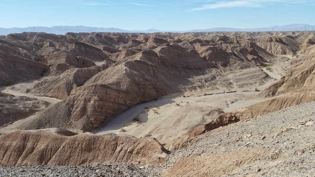
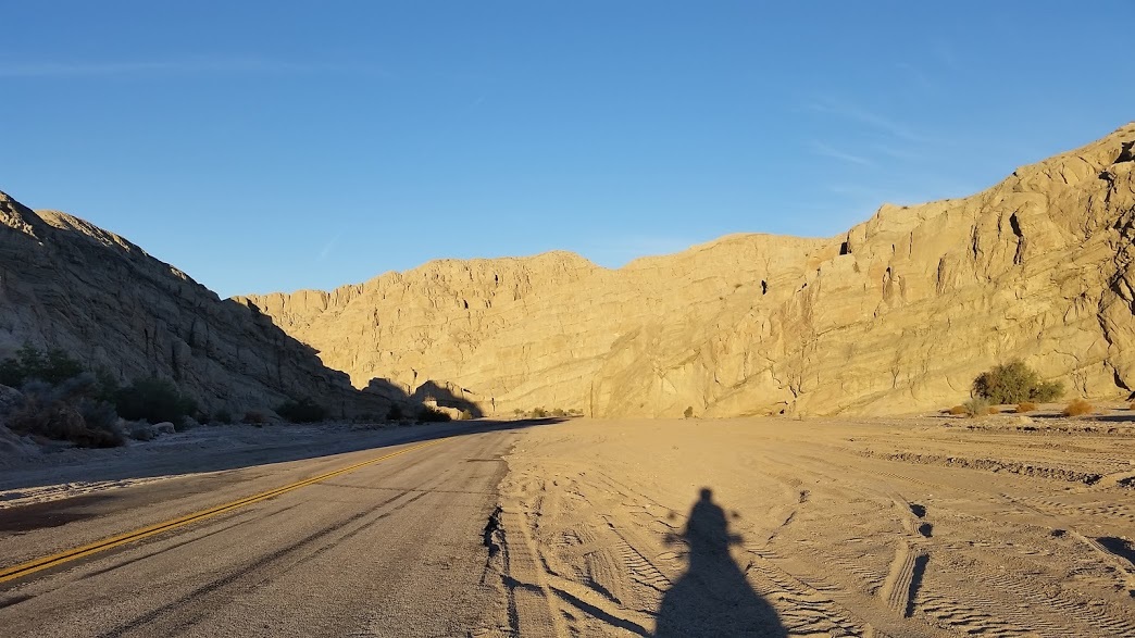
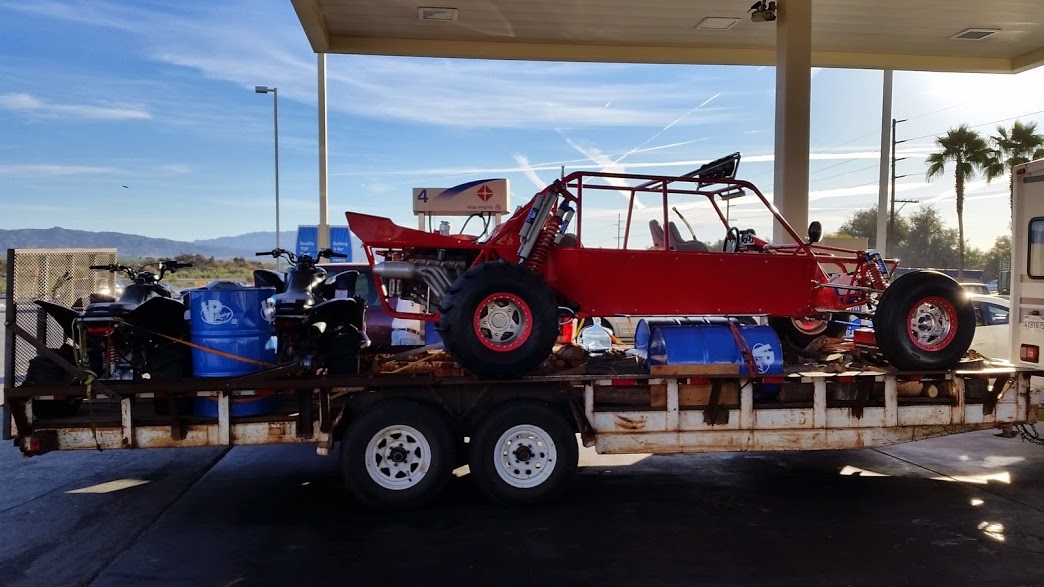
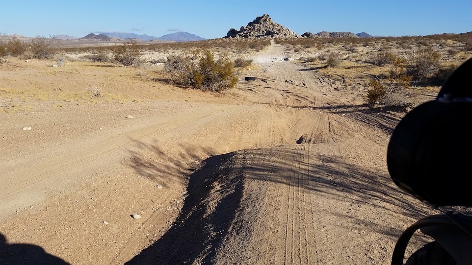
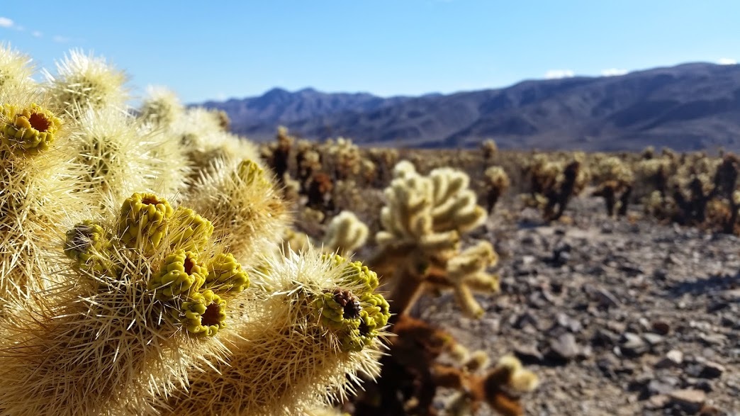
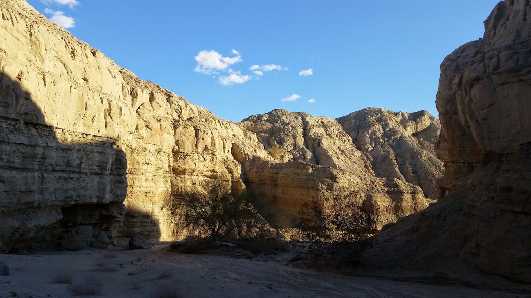
Ocotillo Wells OHV Area - Miles of Sandy Canyon Trails
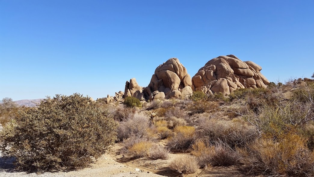
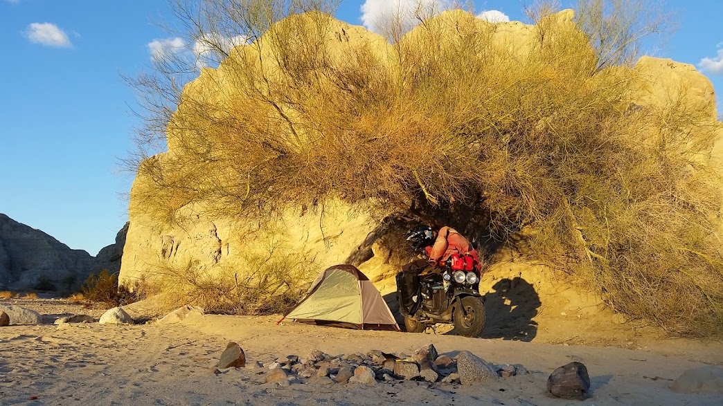
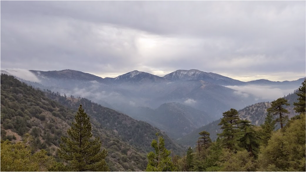
Planning to meet friends in Julian, I made camp in the Anza Borrego Desert State Park somewhere around 3000'.  Scrub oak and boulders shielded the campsite from some of the strong winds coursing over the landscape.  Gusts buffeted my tent overnight and forced me to pile boulders on the Ruckus centerstand to keep it upright.   The wind howled through the night, slapping the tent with force from every direction in the dusty gyre.  I awoke in the morning to a gritty sleeping bag in a still and calm world.


Picture
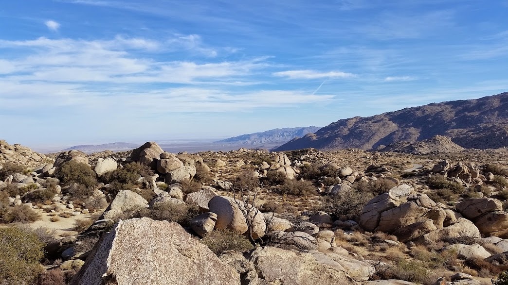
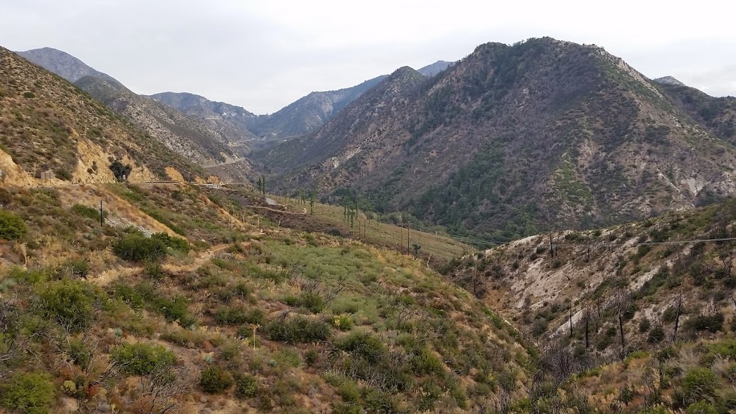
A view overlooking the boulder strewn campground where the desert meets the scrub oak forests
Picture
Picture
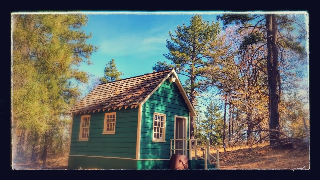
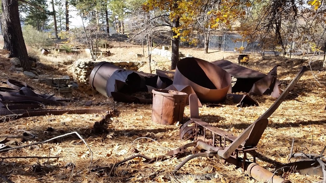
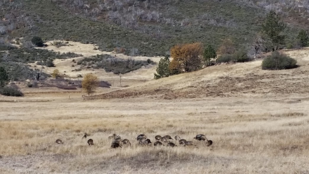
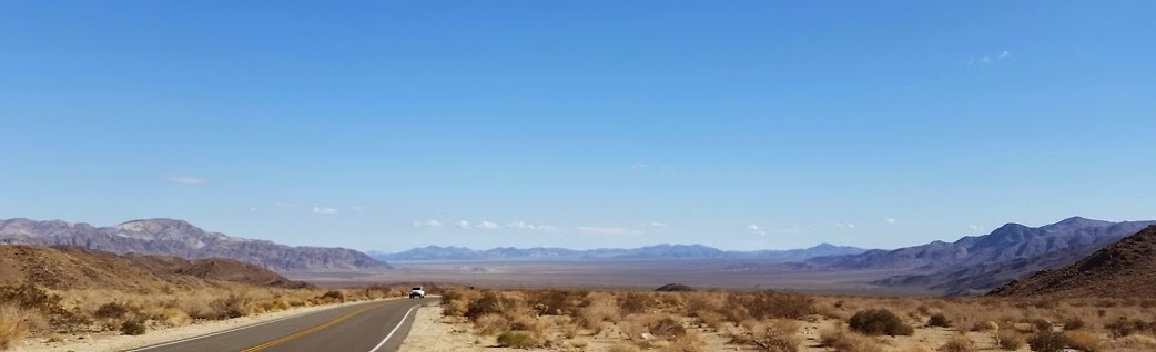
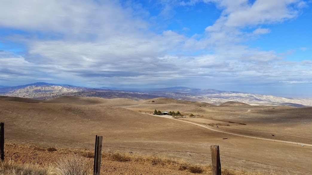
Morning temperatures in the 40's made for chilly fingers and occasional stops in the sunshine to warm up.  I had some time to kill before being in Julian so I headed for Lake Cuyamaca higher into the mountains.  Pine forests and grasslands dominated the landscape in the park-like setting.  Exploring up to an old Gold Mine, I read historical markers about the colorful past and quest for gold that helped settle this region.  A gaggle of turkeys pecked across an open grassland ranch, a fitting welcome for Thanksgiving.  I would spend the holiday with friends in Ramona for a week of relaxation, hiking and fixing up gear.


Picture
Picture
Picture
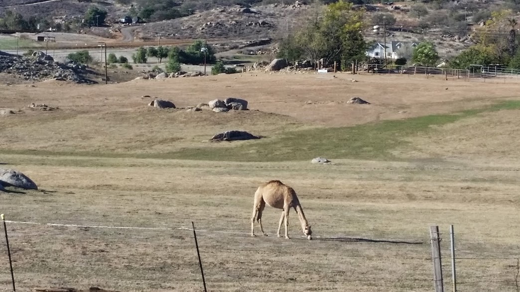
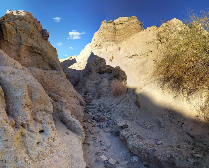
The Oasis Camel Dairy, one of only a handful in this part of the world.
I signed up with the US Dept of State's STEP program, bought Mexican motorcycle insurance and plan to slip south through the Tecate border crossing next week headed for Baja California Sur.  The myriad of blogs and advice pieces for travelers has offered great information about what to expect on the road ahead, namely, the unexpected :)

A few of the items I'm perusing may be of use to any other's future travels south.

http://moon.com/2011/10/best-of-baja-road-trip/
http://www.mexconnect.com/articles/3812-driving-the-baja-highway
http://songoftheroad.com/2014/01/baja-mexico-camp-site-list/
http://capitolsouthbound.com/2012/07/16/our-top-12-camping-spots-in-mexico-part-1-baja/
8 Comments

Salton Sea ApocAlypse

11/27/2014

0 Comments

 
I enjoyed oatmeal and coffee as the sun rose to warm the box canyon.  The scooter purred as I suited up and began chasing my shadow down the narrow sandy canyon amid the cool shaded cliffs and warming washes, growing ever closer toward Mecca.
Picture
Picture
Yes, Mecca is the name of a small agricultural town at the north end of the Salton Sea.  Passing over a wide concrete irrigation channel, it was clear how integral this body of water was to the survival of farmers and cities to the north and south.  Groves of grapefruit, lemon, oranges and palm trees stretched to my right while my vantage point on the hill offered a glimpse of the blue sparkling waters to my left.  A few lemons had rolled close to the road so I pulled onto the shoulder and gleaned a small Vitamin C rich snack for later.  Mecca was mostly a ghost town of trailers, boarded shops and a distant highway diverting traffic to a bustling super-gas-station packed with RV's, desert sleds, dune buggies and long trailers with all manner of OHV's.  
I collect water, gas up and promptly exit the busy parking lot for the 65 mph Highway 86 headed south down the west side of the Salton Sea. Located directly on the San Andreas Fault, the Salton Sea is actually 234 feet below sea level and saltier than the Pacific Ocean!  The modern sea was created in 1905 by a fluke of engineering when a cut was made in the bank of the Colorado River in fear of silt buildup.  This inadvertently overwhelmed the canal, followed by the unabated flow of the entire river into the basin for two years until being restored.
Picture
Picture
I turned off the fast-paced highway into the impoverished town of Salton Sea Beach.  Bumping over the cracked and weathered asphalt, I observed the small 1960's era homes in various conditions from well kept and maintained to abandoned foundations on dusty lots.  The few locals I saw eyed me with suspicion rather than returning my wave.  Many homes had VW Beetle dune-buggies or desert quads parked under lean-to car ports.  Dusty lawns and few trees hinted at the water crisis and lack of suitable drinking water.  Weaving through burned out trailers and graffiti covered abandoned structures, I reached the empty beachfront. 
Picture
Picture
Picture
Picture
The rotten dock anchored 50 feet from the shore hinted at the fluctuations and decreasing water level from variations in agricultural runoff, drought and irrigation demands.  Pelicans graced the surface and gulls scattered in a bustle of squawking white.  Glancing down at the crunch of my dusty boots, I realize I am walking on a beach of fish skeletons and calcium bleached white by the sun.  Dead fish ring the shoreline closer to the waters edge emitting a noxious odor reminiscent of an oceanside cannery on a hot day. 
Picture
The water that once appeared blue and beautiful from a distance reveals itself as a brown concoction of algae, dead fish and floating waste.  Submerged tires and discarded furniture litter the shoreline in this, the most apocalyptic beach I've ever visited.
Picture
0 Comments

California's Southern Desert

11/27/2014

2 Comments

 
A few sprinkles of rain overnight were completely evaporated by the wind and dry climate by morning. The new tent held up respectably in the windy conditions, a bit cramped fro my liking but easy enough to hide behind the Ruckus!  Out on the highway, the small city of Hesperia unfolds around me where I stop for coffee and a brief blog post to update any followers as to my whereabouts.  When in "Travel Mode" on the short sunny days of fall, I find it difficult to stop and waste time blogging or dealing with internet when the daylight is so precious. My GPS is set on Joshua Tree National Park, roughly 80 miles away across the open expanses of shrubs and rock that comprise the high Mojave Desert.  My saving grace for neck fatigue and mpg is the glorious tailwind propelling me toward my destination as if some agreement had been reached with the heavens.
Picture
By 10AM, I regain feeling in my fingers after the sun bakes away the morning chill.  It takes a few hours of riding and skirting the higher speed highways but I eventually make it to the surprisingly populated town of Yucca Valley.  Tall palm trees dot the skyline and a number of subdivisions and buildings pepper the desert valley.  The military base of Twenty-Nine Palms as well as a number of other defense related industries help to sustain the surrounding towns.  A brief stop for groceries, water and fuel (my three essentials), then I head for the park.  Flashing my National Parks Pass, I smile and accept a map of the park road and available recreation in the area.  The main road through the park was relatively traffic free and empty on this weekday, which weekday? I have no idea. 
Picture
Picture
The high Mojave Desert climate on the northern end of the park represents an amazing diversity of desert plants such as Pinyon Pine, Juniper and Joshua Trees.  Amazed at the unusual landscape, my mind struggles to describe the sharp pointed spikes, thorns, cacti and water conserving plants. I lack a suitable history of experience and have no clue where to begin in photographing or writing about the life before me.  Perhaps during sunset where the rocks are painted red and the trees silhouetted against the mountains it will all make sense? A lizard runs across the sandy surface near my footfall to hide underneath a cool rock.  
Picture
 The park is crisscrossed by hundreds of faults and evidence of recent geologic changes shape the rocks and mountains wherever I look.  Overwhelmingly curious, my mind struggles to comprehend the environment unlike any place I've traveled before.   Sandy tire tracks stretch off on side road adventures but the relatively narrow and small Ruckus tires prevent me from chasing dreams of bounding over sand dunes.  The Park Road soon drops lower in elevation and the gnarly alien Joshua Trees begin to dwindle, overtaken by low vegetation of chollo and ocotillo and sage. 
Picture
Picture
Before me is a magnificent panormaic view of protected wilderness stretching to the mountains 20-30 miles distant.  
Picture
Exiting the park through BLM land, I promptly head over an Interstate without even glancing for consideration.  The elevation begins to drop as I travel south down Box Canyon Rd toward the Salton Sea.

Picture
 Near vertical sandstone walls devoid of vegetation reflect the extremes of desert erosion by wind and rain.  A small pull off into a dry tributary of the canyon offers a simple fire pit and small tree bordering the wilderness in which to camp.  I go for a hike up the canyon along a meandering course cut deep into the soft sandy rocks.  Debris scattered through the riverbed hints at human presence upstream and the off-roading past of this now protected wilderness.  

Picture
Temperatures overnight never fall below 50 and the breeze is nearly non-existent. Falling asleep, my eyes carry through the mesh toward the array of stars appearing the darkening sky.  A quiet night, not even a coyote's howl to gleefully break my sleep.
Picture
Picture
2 Comments

Los Angeles COUNTY...My Way

11/25/2014

1 Comment

 
I followed the highway down to the foothill town of Maricopa for gas, one of the few open establishments in the tumbleweed town decaying into the past.  From here I climbed over 3000 ft back up toward the Los Padres National forest savoring the dry air and clear 60 mile views of the Carrizo Plain stretching behind me.  
Picture
Picture
 Twisting ever higher into the mountains, the grasslands slowly gave way to pine forests with sandy floors.  The cold breezes on the exposed mountains lead me lower to Lebec for gas and the decision to drop into the greater LA area or continue skirting it through the mountains to the north...I'll let you decide which route I took!  By 4:45, the sun began to set and I pulled in to an abandoned driveway of hummocked sand leading to an old foundation with 30+ year old trees growing through it. This offered a quiet and secluded spot to hang my hammock for what would wind up being my last night in the Hennessy hammock this year.  I woke before dawn to temps in the low 40's where I could see my breath while packing and making coffee in the quiet of morning.  The sun began to poke over the mountain ahead so I rode down to Lake Hughes, an alkaline lakebed of white rime where a vacation destination once thrived.  The drought stricken regions of southern California are swiftly adjusting property values and the "worth" of certain locations that once hosted tourism or a vacation draw, since replaced by sand and dying vegetation.  Turning into the canyon, I follow the beautifully carved road around a fire-scorched landscape of blackened scrub oak and recovering shrubs and cacti slowly reclaiming the land.  I am amazed at how extensive the wildfire damage is throughout the area where much of the recreation in the forest remains closed as a result.  In Lake Castiac, Santa Clarita's aquifer, docks sit on the sand as the receding water levels plunge lower into the manmade basin.   I can't imagine the fish in there are edible or the water quality sufficient to support an ecosystem.
Picture
The smell of diesel fuel and combustion greets me at the interstate.  So sharp and pungent are the smells of society when one has been sequestered in nature.  The scent of leather interior and cologne wafts from a shiny new SUV at the stoplight, just before the driver chirps the wheels at the first hint of green. I too am in a hurry, to escape the trappings of this city!  I plug in the REI store over the mountain then follow a series of residential streets to my destination.  I go grocery shopping until they open at 10 then purchase a new REI Passage I tent using a discount I have.  The small sub 4lb one man tent should serve me well over the next few months of camping in places without trees.  I mail home my hammock and 12ft tarp then immediately head for the hills through stoplight traffic, buses and smartphone distracted drivers.
Picture
NOT my campsite...thought it could have been!
I soon find myself chugging up the Tujunga Canyon north of town.  I climb from the low and dry riverbed high into the brown and tan mountains.  Forest fires have left no trees in sight from my vantage point as I survey the 4-5000ft ridges overhead.  Erosion and deforestation on account of the fires and drought have stripped the valleys of much of their natural grandeur and balance.  Concrete dams erected every few miles along the riverbed below are designed to help abate the mudflow and flash floods common during the wet season.  Select sensitive species of fish and aquatic plant struggle to call this area home as a result of man's intervention in the landscape.
Picture
Evidence I was in "LA"
Reaching Highway 2, I turn left onto the Angeles Crest Hwy, a scenic ridgeline parkway running generally SW to NE across the Angeles National Forest.  There is little to no traffic on this weekday afternoon, allowing me to slowly climb the mountains higher and tackle the downhill grades with centerstand dragging ease. The smog of the city obscures any chance of a glimpse of LA, not that I cared to see it anyway.  Gone is the parking lot heat of the city, a cool breeze blows on my neck raising goosebumps on the skin.  At 4000ft, I still have a long way to climb.  
Picture
The view down after my 7000 ft climb to Cloud Burst Summit
Miles of twisty scenic ridgeline roads remind me of the Blue Ridge Parkway without deciduous trees.  The ravages of forest fires slowly dissipate as my elevation climbs to 5000ft...then 6000, 7000 and finally up to 7900 ft at Dawson Saddle.   Snow blankets the northern facing hills between 7500-8000 ft and ice lines the deeply cut roadside ditches.  Bundled up against the cold, I chuckle at the extreme change in temperature from my morning in the city to my afternoon on the mountain.  The sharp cutting wind and approaching cloudfront socks me in while I finish my slowly cooked dinner of chicken soup at 7000 ft.  Small scale ski resorts line the roadway offering winter recreation for the sunkissed masses of SoCal.  Lifts sway in the breeze and tracked vehicles wait for the short winter season to arrive.  Ski runs of sand and dirt offer a different kind a powder during this time of year. Simultaneously, the elevation, temperature and sun plummet lower on their respective scales.   "I've got to get off this mountain", I comment to nobody in particular, secretly wanting to stay for a storm and test the new tent.  
Picture
Snow above 7500ft!
Twisting down through log cabin resort towns and getaway destinations, I reach the high desert town of Phelan where Joshua Trees and cacti common to this Mojave Desert environment greet me.  The extremes in landscape and microclimate during my single day of travel have been mesmerizing.  Out on the highway, a line of headlights stretches in my mirror into oblivion. I pull off on a small sandy lane to pull in behind a shipping container, behind a Lutheran Church. With the engine off, the sound of wind against my helmet draws my head around to take in the glorious sunset behind me.  Orange and pink clouds float through a purple sky contrasting sharply above the darkened mountains from which I came.  The wild bark of a dog reaches my ears from an adjacent parcel to disappear on the wind, into the darkness of a high desert night.
Picture
1 Comment
<<Previous
    Where is Mike?

    Mike Saunders

    In May 2014 I quit my job to ride a Honda Ruckus over 69'000 mi and counting. Wild camping most nights and cooking most of my own meals, I keep the costs low and the landscape changing. 

    Archives

    April 2018
    March 2018
    February 2018
    January 2018
    December 2017
    November 2017
    October 2017
    September 2017
    August 2017
    June 2017
    May 2017
    April 2017
    March 2017
    February 2017
    January 2017
    October 2016
    September 2016
    September 2015
    August 2015
    July 2015
    June 2015
    May 2015
    April 2015
    March 2015
    February 2015
    January 2015
    December 2014
    November 2014
    October 2014
    September 2014
    August 2014
    July 2014
    June 2014
    May 2014
    April 2014

    Picture
    Picture
    Picture
    Picture

    Social

    RSS Feed

Powered by Create your own unique website with customizable templates.
  • Scoot
  • Paddle
  • Pedal
  • Moto
    • The South >
      • Merchant's Millpond State Park, NC
      • BRP and a visit to Charlotte, NC
      • South Carolina and Back on my GS (2011)
      • Jaw-ja Trip #1 - Visiting my Nephew
      • Jaw-ja Trip #2 - Cousin's Wedding
      • "You rode 1300 miles for BBQ?!?" (2010)
    • Canada (eh) >
      • 2012 - Beards to Canada >
        • Day 1: Arlington, VA > Arlington, VT
        • Day 1-2 (Continued) Back to VA!!!
        • Day 3: Newburyport, NH > Sandy Cove, NS
        • Day 4: Loafing around "The Neck"
        • Day 5: Sandy Cove, NS to Antigonish, NS
        • Day 6: Antigonish, NS to Meat Cove, NS
        • Day 7: Meat Cove, NS to Port Aux Basques, NFL
        • Day 8: Port Aux Basques to Port Saunders
        • Day 9: Port Saunders to Big Brook
        • Day 10: Big Brook, NL to Trans Lab Hwy
        • Day 11: Trans Lab Hwy to Pinware River
        • Day 12: Pinware River, LAB to Norris Point, NL
        • Day 13: Norris Point to Blue Beach
        • Day 14: Blue Beach, NL to Port Aux Basques Ferry
        • Day 15: Sydney, NS to Sandy Cove, NS
        • Day 16: Chillin on the Digby Neck
        • Day 17: Sandy Cove, NS to No. Sandwich, NH
        • Day 18: Sandiwch, NH to Arlington, VA (Home)
      • Algonquin Park 2013 >
        • Day 1: Home to New York
        • Day 2: Chataugay State Forest to Brent, ON
        • Day 3: Brent, ON to Nipissing River Portage at Nadine Lake
        • Day 4: Nipissing River @ Nadine Lake Portage to first island in Red Pine Bay
        • Day 5: Red Pine Bay to Hogan’s Lake
        • Day 6: Hogan’s Lake to Catfish Lake
        • Day 7: Catfish Lake to Cedar Lake to Fredonia, NY
        • Day 8: Fredonia, NY to Brookville, PA
        • Day 9: Brookville, PA to Alexandria, VA
      • Think I'll ride to Montreal this weekend...
      • Ontario on a Whim
    • Maryland >
      • How to Hit a Tree, By ME!
      • Ruckus Stealth Camping in MD
      • Ruck'n around Southern MD
      • White's Ferry and some Maryland Backroads
      • 1000mi right near da' beach (2010)
    • New York >
      • Cornell, Niagara Falls and PA Coal Country (2012)
      • Finger Lakes trip to NY (2011)
      • New York City Trip (2011)
    • Pennsylvania >
      • Early Spring in PA
      • Michaux Camping
      • From a Wedding to "Where-da-fugawi?"
      • Pennsylvania Leaf Peeping (2012)
      • First Big Trip to PA (2010)
    • Virginia >
      • From the Mountains to the Sea in Ol' Virginny'
      • What the Fog? (Northern Neck, VA - 2013)
      • Uncle Bucks Ride to Eat and Snowy SNP
      • Charlottesville Area Ride
      • Serious Helmet Time in VA (2011)
      • Ruck'n Across Virginia (2010)
      • Impromptu Camping with 'DC Rider' (2010)
    • West Virginia >
      • Rella-Vous and Skippii Rescue
      • New River Gorge Ghost Town Exploration (2011)
      • Five States from Laurel Fork (Spring 2013)
      • A Little Dirt, A Little Clouds, A lotta Fun, WV (2012)
      • GS and an NSX? (2012)
      • Seneca Rocks Camping Two-Up (2011)
      • Panniers Only Club at Seneca Rocks, WV (2010)
      • Laurel Fork Fall 2010 on the Honda Ruckus 50cc (2010)
      • Dog Days Rally and Rella's Gift (2010)
      • Pops and Richmonders in WV (2010)
      • Rocket Boys (2010)
      • New River Gorge and Rella's (2010)
    • Cross Country 2009 >
      • Trip Preparation
      • Day 1: (Sept 3, 2010)
      • Day 2: (Sept 4, 2010)
      • Day 3: (Sept 5, 2010)
      • Day 4: (Sept 6, 2010)
      • Day 5: (Sept 7, 2010)
      • Day 6: (Sept 8, 2010)
      • Day 7: (Sept 9, 2010)
      • Day 8: (Sept 10, 2010)
      • Day 9: (Sept 11, 2010)
      • Day 10: (Sept 12, 2010)
      • Day 11: (Sept 13, 2010)
      • Day 12: (Sept 14, 2010)
      • Day 13: (Sept 15, 2010)
      • Day 14: (Sept 16, 2010)
      • Day 15: (Sept 17, 2010)
      • Day 16: (Sept 18, 2010)
      • Day 17: (Sept 19, 2010)
  • Photos
  • Articles