Lost with Mike
  • Scoot
  • Paddle
  • Pedal
  • Moto
    • The South >
      • Merchant's Millpond State Park, NC
      • BRP and a visit to Charlotte, NC
      • South Carolina and Back on my GS (2011)
      • Jaw-ja Trip #1 - Visiting my Nephew
      • Jaw-ja Trip #2 - Cousin's Wedding
      • "You rode 1300 miles for BBQ?!?" (2010)
    • Canada (eh) >
      • 2012 - Beards to Canada >
        • Day 1: Arlington, VA > Arlington, VT
        • Day 1-2 (Continued) Back to VA!!!
        • Day 3: Newburyport, NH > Sandy Cove, NS
        • Day 4: Loafing around "The Neck"
        • Day 5: Sandy Cove, NS to Antigonish, NS
        • Day 6: Antigonish, NS to Meat Cove, NS
        • Day 7: Meat Cove, NS to Port Aux Basques, NFL
        • Day 8: Port Aux Basques to Port Saunders
        • Day 9: Port Saunders to Big Brook
        • Day 10: Big Brook, NL to Trans Lab Hwy
        • Day 11: Trans Lab Hwy to Pinware River
        • Day 12: Pinware River, LAB to Norris Point, NL
        • Day 13: Norris Point to Blue Beach
        • Day 14: Blue Beach, NL to Port Aux Basques Ferry
        • Day 15: Sydney, NS to Sandy Cove, NS
        • Day 16: Chillin on the Digby Neck
        • Day 17: Sandy Cove, NS to No. Sandwich, NH
        • Day 18: Sandiwch, NH to Arlington, VA (Home)
      • Algonquin Park 2013 >
        • Day 1: Home to New York
        • Day 2: Chataugay State Forest to Brent, ON
        • Day 3: Brent, ON to Nipissing River Portage at Nadine Lake
        • Day 4: Nipissing River @ Nadine Lake Portage to first island in Red Pine Bay
        • Day 5: Red Pine Bay to Hogan’s Lake
        • Day 6: Hogan’s Lake to Catfish Lake
        • Day 7: Catfish Lake to Cedar Lake to Fredonia, NY
        • Day 8: Fredonia, NY to Brookville, PA
        • Day 9: Brookville, PA to Alexandria, VA
      • Think I'll ride to Montreal this weekend...
      • Ontario on a Whim
    • Maryland >
      • How to Hit a Tree, By ME!
      • Ruckus Stealth Camping in MD
      • Ruck'n around Southern MD
      • White's Ferry and some Maryland Backroads
      • 1000mi right near da' beach (2010)
    • New York >
      • Cornell, Niagara Falls and PA Coal Country (2012)
      • Finger Lakes trip to NY (2011)
      • New York City Trip (2011)
    • Pennsylvania >
      • Early Spring in PA
      • Michaux Camping
      • From a Wedding to "Where-da-fugawi?"
      • Pennsylvania Leaf Peeping (2012)
      • First Big Trip to PA (2010)
    • Virginia >
      • From the Mountains to the Sea in Ol' Virginny'
      • What the Fog? (Northern Neck, VA - 2013)
      • Uncle Bucks Ride to Eat and Snowy SNP
      • Charlottesville Area Ride
      • Serious Helmet Time in VA (2011)
      • Ruck'n Across Virginia (2010)
      • Impromptu Camping with 'DC Rider' (2010)
    • West Virginia >
      • Rella-Vous and Skippii Rescue
      • New River Gorge Ghost Town Exploration (2011)
      • Five States from Laurel Fork (Spring 2013)
      • A Little Dirt, A Little Clouds, A lotta Fun, WV (2012)
      • GS and an NSX? (2012)
      • Seneca Rocks Camping Two-Up (2011)
      • Panniers Only Club at Seneca Rocks, WV (2010)
      • Laurel Fork Fall 2010 on the Honda Ruckus 50cc (2010)
      • Dog Days Rally and Rella's Gift (2010)
      • Pops and Richmonders in WV (2010)
      • Rocket Boys (2010)
      • New River Gorge and Rella's (2010)
    • Cross Country 2009 >
      • Trip Preparation
      • Day 1: (Sept 3, 2010)
      • Day 2: (Sept 4, 2010)
      • Day 3: (Sept 5, 2010)
      • Day 4: (Sept 6, 2010)
      • Day 5: (Sept 7, 2010)
      • Day 6: (Sept 8, 2010)
      • Day 7: (Sept 9, 2010)
      • Day 8: (Sept 10, 2010)
      • Day 9: (Sept 11, 2010)
      • Day 10: (Sept 12, 2010)
      • Day 11: (Sept 13, 2010)
      • Day 12: (Sept 14, 2010)
      • Day 13: (Sept 15, 2010)
      • Day 14: (Sept 16, 2010)
      • Day 15: (Sept 17, 2010)
      • Day 16: (Sept 18, 2010)
      • Day 17: (Sept 19, 2010)
  • Photos
  • Articles

2200 miles down the Mississippi R.

My River's End

8/22/2016

14 Comments

 
My eyes cracked open to a dim pre-dawn sky above the sandbar on which I camped. This would be the final day of this memorable and continually developing journey down the Mother River and I felt uncomfortably satisfactory. Very rarely do my trips terminate at a random spot along the trail, yet here I was planning to pull off before the river's end. After two and a half months travelling over 2200 miles, I had yet to reach the Gulf of Mexico but had at least reached "second base" on my first date with Ol' Miss. Staring at the mangled mosquito mosaic across the mesh of my tent, I thought about the physical and mental endurance of a trip like this. I came close to my physical limit early on in the trip when I overexerted myself and took a week to fully recover. The stamina to keep my mind engaged and enjoying the adventure in the face of sweltering heat, terrifying tornadoes and rhythmic paddling was often a surprise to myself.

"This too shall pass"
"What doesn't kill you makes you stronger" "F*ck it! Let's go!"

These would probably be the phrases repeated most in my times of stress.

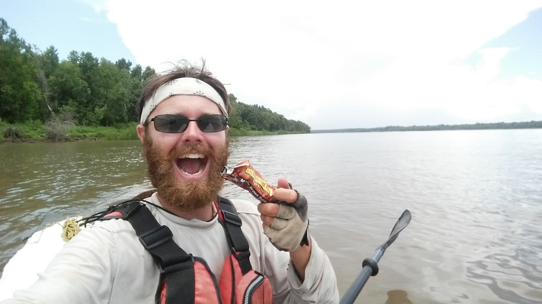
​Draped over a small willow beside my rent is the once bright white long sleeve synthetic shirt I've worn for 75 days straight. I can almost smell the sharp sour tang of the stained and torn rag of a shirt that remained. Sand scratched at my side on the air mattress as I packed up the gear inside and a large part of me missed the idea of sleeping on it again tonight. A shower, full meal, cold beer and soft bed shall be my reward for the expedition and would be here soon enough. The sight of my canoe tied up high along the magnificent river underneath the reddening sunrise reflected warm on the water and my heart. Each day is a gift and within there are many faces to the water and the sky. To me, reaching the "end" of the river became a geographical falacy in the perpetuity of life. The river flows downstream but the sky keeps it full.

Picture
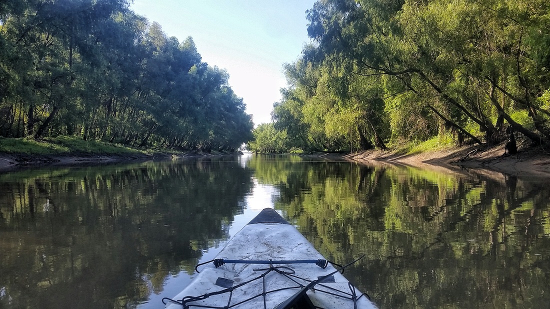
Bonne Carre Island back channel
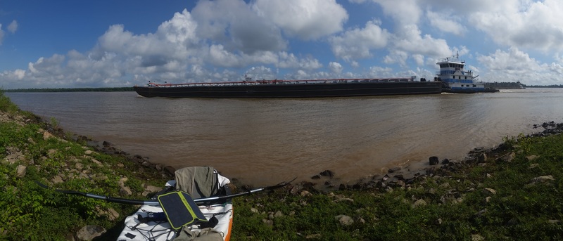
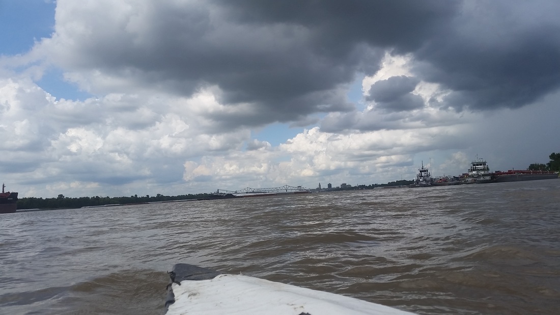
Paddling through the morning,involved multiple tankers, a few blind corners and many active tugboats along the west shore fleeting zones. Considering the two barges being towed into my path by an upstream tug, my eyes scanned the gaps in the fleeted barges for a perfect fit, a nautical Tetris. Keeping left I steered clear and reflected upon how much instinct is built upon river experience and powers of anyltical prediction.


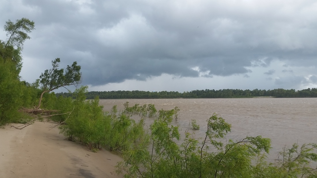
After Bonne Carre point, I passed between the rust coated fleet of barges and up to the last island on the Mississippi. The back channel of Bonne Carre Island was resplendent with squirrel, armadillo, turtles and alligator. A 15ft tall willow bent and I glanced up to see a snake falling with a splash into the mirror surface. It was a fitting moment of calm and collection amid the turmoil of the shipping channel and although I could hear the diesel engines humming away, I felt far removed. Here in this miniature wilderness among the chaos, my mind drifted to Minnesota and the grassy camps of the upper portions. I thought of how far I had come and how content I was with the final few miles of easy paddling among moored tankers along the spillway.
Picture
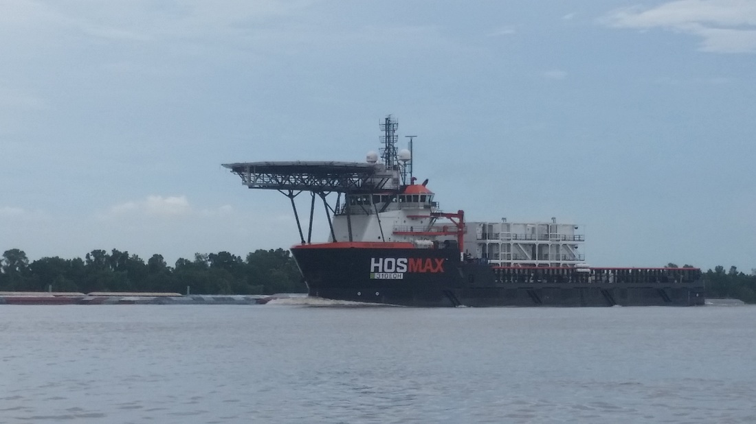
A mobile apartment ship for the oil rigs?
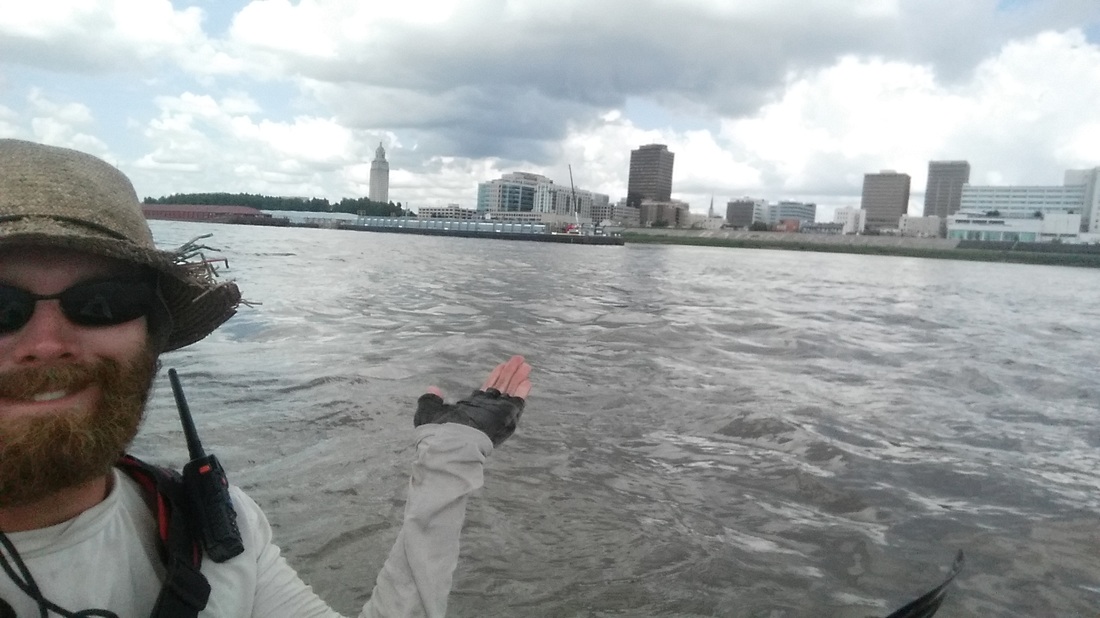
I was soon downwind of the noxious DowChemical factories and not regretting the missing 127 miles of waterway left to be paddled. Styrene barges passing gave me a headache and I worried about the serious levels of unhealthy particulate matter in the air. Yesterday I spotted a hill over 200 ft tall built of rubble dotted with yellow earthmoving equipment. It's home to a carcinogenic metal refining waste that is also radioactive. If the remaining stretch of river was wild, I'd jump at the chance to paddle to its mouth and dive into the expansive Gulf. Up ahead were the crumbling remains of the flood scoured boat ramp, an unlikely but remarkably appropriate finish line.

I had made it...here?

​Yes. I was content to know that the journey was within and without, another life experience to grow upon, another region explored. Although the boat will pass on to new hands, I'm excited for the next adventure. As Dave Grohl said, "Done, done and I'm on to the next one."


See you shortly ;)
Picture
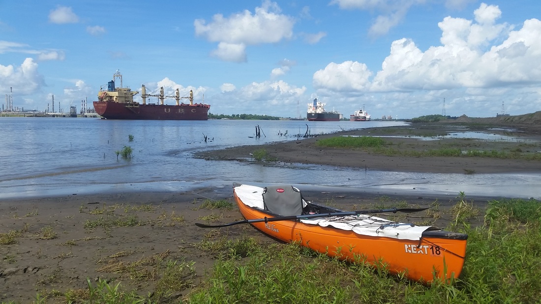
My takeout near the spillway
Picture
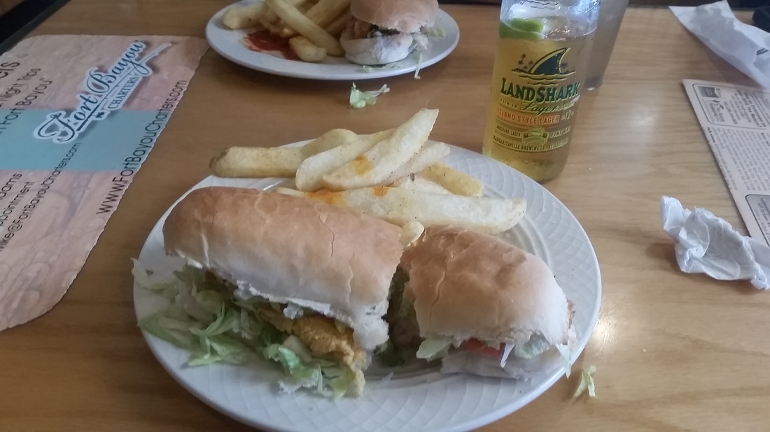
Fish Poboy and a Landshark to celebrate
14 Comments

The Countdown.

8/18/2016

7 Comments

 
Picture
5 ships simultaneously passing put me on the shore
Picture
I've arranged to meet my family at the last boat ramp before New Orleans. This should put me there by Saturday afternoon considering the daily afternoon storms. They're almost predictable now. My 2pm appointment today allowed for planning and time to set up a tarp, make lunch and repack some items. A nice break mid-day that i was completely ready for.

​
Picture
my new go to shelter for tstorms. face away from wind.
7 Comments

Baton Rouge. Check.

8/17/2016

5 Comments

 
My notes are typically brief since it takes much patience to type all of my thoughts into my phone. If you were curious what a typical day on the lower river is like, this is a just description. It's a bit long but I'm "OK" in the end.
Picture
Baton Rouge
The familiar 5:30 alarm sounded and sent a flashing light through my tent. I had been up since 4:45 partially from the 10 degree angle of my tent which kept my clawing my way back to the top, and mostly on account of the thudding twin 3000 hp diesel engines of a northbound tow only 200 feet from my tent. I yawn, pull myself together and begin packing the tent like I do each morning. Getting the tent and gear packed while still dark is usually my goal so that I can enjoy coffee and breakfast before paddling without wasting precious daylight. I shim the cup of oatmeal between my spare paddle and carwash sponge in the canoe and shove off from the sandy beach at Cajun Condo (lrm 270). A monochrome environment dense with fog plays tricks on my vision leading to floating spots from trying to look through the mist to discern through the sharp edges of a barge or boat. I clean my glasses but the fine sand that coats everything only scratches the lenses more. The town of St. Francisville was supposed to be the first stop of the day but I knew I'd kill at least 3 hours walking in, getting coffee and charging my marine radio. As is typically my want, I forego the comforts of wifi, coffee and conversation for the demands of the adventure. Creature comforts are fleeting but danger and adventure are sure in my daily life.


The fog thickens as I round the bend and can barely descern the enormous concrete docks lined with coal barges for the Big Cajun Power Plant. I avoid them and start my morning with a channel crossing in a blind fog where I can just barely make out the opposite bank. The one beauty of fog is the ability for sound to carry for miles. I listen for the thud of an upstream engine but hear none against the din of industrial equipment and the hum of highway traffic in the distance. My map shows an enormous bridge spanning the river and I should be right on it but have yet to find it in the fog. This location is known as "the Narrows" by captains as the river shrinks to a mile wide corridor of fast paced water with swirling eddies and poqerful whirlpools beneath the bridge supports. This is not a place to meet a passing ship in the fog. Taking a sip of my coffee, I look up and behold the pilings of the bridge but cannot make out the deck some 70 feet above. I slide past on the left bank and continue paddling into the fog, enjoying the day and the quiet.


Within a few miles, the fog lifts and I set up my solar panel to charge my depleted battery. Glancing at my Rivergator guide, I notice a shortcut down Profit Island Chute accessible only above 15ft on the Baton Rouge gauge. Today its at 18ft so I take their word for it and head down the chute with eyes wide for the rock dam built for larger vessels. Fortunately I slide on over in a minor eddie and enjoy the back channel free of tow boats. The chute's exit was once the sight of a major ship collision during the Trail of Tears in which hundreds of natives died. I had a moment to consider that grim history and avoided a collision myself when starting to cross the channel before a downstream tow. Good thing I double checked since there were two ships coming down. They kept me in the slow water on left where I remained up to Thomas Point.


In the distance I can see the billowing cloud from the ExxonMobil refinery and smell the scent of pulp paper mill on the breeze. I hear a siren and loud whirring that I guess is a Tornado warning. Doubtful of that after a scan of the cumulus sky, I strain my ears and can hear the automated voice warning to evacuate now to a National Guard shelter. I just happened to float past one of the many flood evacuated towns north of Baton Rouge. It gabe a somewhat eerie feeling to the day, as though recreating through a disaster zone. 30'000 people have been rescued thus far from the rising waters. If only they had an Old Town Next Canoe!


Approaching the point, I could hear the crackle of my radio and the captain's southern twang as he said "Mary Clay southbound Thomas Point. Over." Glancing to the sky, the sun is directly overhead so I extract a can of Campbells Pork and Beans from my soggy backpack and eat it cold as the waves from the tow toss me about. This point however is one of the blind curves at nearly a right angle so the red buoys are right up on the point. I rounded the bend wide eyed and cautious but wasn't met with any northbound traffic. Phew! What I could see ahead was a staggering amount of boats, barges and equipment. It's hard to tell what's docked and what's moving among the many tow boats and fleeted barges. A sign should hang around Thomas Point saying "Welcome to Cancer Corridor" but I only noticed the eroding bank and a deflated basketball. Keeping the paddle swinging, I approach the last bend before Baton Rouge harbor. I key my radio and announce "Canoe southbound Wilkinson Point" then round the bend to behold the chaos. I keep right bank passing a couple fishing across from a dredging vessel emitting a 20 foot arc of brown water. I'd rather run afoul of their tackle than this ship and chat as I pass. The dirty yellow flames of an oil refinery gas flare dance on the wind and I feel bad for the folks who have to eat the fish from this portion of the river. A massive oil tanker showing 20 feet of its waterline is docked at the refinery but I don't have time to contemplate what that would look like bearing down on me. Continuing for a mile or two, I come upon two active tug boats and what appears to be an upstream tow under the bridge giving me nowhere to go. Shit. I change tactics and make the decision to pass to left bank across the busy lane while I have a chance. Turning perpinduclar to shore as instructed, I paddle swift and hard, digging deep to fight the impossibly strong current that builds against my port gunwale. A glance downstream shows me getting farther from the busy activity but closer to the bridge and fleeted tankers mid-river. My first though was that the tanker was barreling down the main channel but I soon realized it was stationary. To my left, the office buildings and uninspiring skyline of Baton Rouge loomed over the rows of fleeted barges. Halfway through. I pass under the busy stop and go traffic of the I-10 bridge and quickly must thread the needle between mooring pilings and the bow wake of an approaching tug.


I'm admiring the size and design of the tanker to my left when I hear a ship horn blow behind me. Constantly scanning my horizon, I'm horrified and disappointed to see a downstream tow 5 barges wide barreling down on me. It must have been obscured by the fleeted barges and blended in. It's narrow between the moored tanker center channel and the active petroleum barges nosed into the bank. The horn bellows once more and although I'm already paddling to shore, I get a small jump and paddle faster. The blades whir over my head as spray splashes my face and pelts the canoe. I make out the heaping piles of coal on the approaching threat and consider how unlikely it would be that one of Appalachia or Pennsylvania's mountains sunk me to my end. Since you are reading this, you know I made it out of harm's way but it was one of my closer calls thus far. The trees begin to reappear on the banks and after the appropriately named Red Eye Dikes, I'm through the Baton Rouge harbor. Phew.


As if on cue, a rumble of thunder breaks from the towering cumulonimbus to the south. I had been dodging the storms all day, really for two weeks, and hoped I may be able to keep ahead of this one. I was making great speed when suddenly a wall of water began dancing across the river toward me from the southeast. The splash of the driving rain turned the river white and drowned out all sound of macinery and equipment from the adjacent fuel refineries. I kept paddling on waiting to hear thunder again, as if the first rumble belonged to another nearby cloud. Sizzle and KA-BOOM! So much for finding a safe place to stop. The eroding muddy bank was narrow and steep leading to a 6-10 ft vertical wall of mud and soil horizon held together by gnarly roots. This will have to do for shelter so I pull up and step out, sinking my Croc to the ankle and nearly losing it when suction rips it off my foot. I heave and drag the canoe up the steep chunks of mud, losing a half pull for each yank of the canoe. It keeps trying to slide back down the slippery mud into the river but who could blame it with the 30 degree angle of the bank. Good ol gravity. It's too muddy and messy to flip to boat so it quickly fills with rainwater turning into a swimming pool. Kneeling in the mud beside my boat, I shield my eyes from the brilliant flashes of light overhead. I count "One Mississippi, two Mississippi", chuckling at the apropritate absurdity of it all as I'm only two feet from the Mississippi itself. The crash comes before I can count to three meaning it's within a half mile of me. The rain hammers on with an intensity not yet felt on the two and a half months of travel. I kneel in the growing stream of mud from the bank, feet slowly sinking in, shivering from the cold rain and consider how thankful I am to have made it through the port before this deluge. The next two hours are spent on the verge of shivering huddled in the mud staying low to avoid getting zapped. The bank is to sheer to climb and there's a solid chance my boat my slide away if I let go. Every thirty minutes I shimmy down to the stern and use my trusty metal cup to bail out the foot of water pooling amid my water jugs and tarp bag. The storm was really a series of continual powerful cells that raced upon each other creating multiple squall type walls of water and shore obscuring density. It was intense and now growing darker with the onset of night. The oncoming clouds were obscured by the mud bluff so I had no way of knowing what was next to come. The rain let off but the lightning continued as the storm raced north. I weighed my options and decided to shove off and paddle to the first reasonable landing with access to the forest. No sooner had I dipped my blade in the water when a shocking bolt of lightning arced across the sky overhead accompanied by a cacophonous explosion. "Sorry Dad" I say out loud, remembering my promise not to paddle in lightning. The continual flashes posses a golden color in the twilight offering snapshots of the insurmountable shoreline. I stick a flashlight in my mouth so upstream tow can see me and paddle hard and fast, body fueled my adrenaline. There! A shallow sloping bank. Leaning backward, I approach with such speed that I slide halfway up the mud shore and step out onto the harder sand. Camp. The forest is a dense jungle of vines, invasive species and short willow so I clear a spot large enough and put up the tent when I'm not being carried away by the skeeters who've taken to my exposed flesh. I hit the OK button on my Spot tracker and know the batteries are nearly dead and there is a slim chance the message will get through. In lieu of the email, as the SPOT message says, I'm just writing to let you know I'm "OK".
Picture
oncoming tow. tanker just to left of shot
5 Comments

Storm of funkĀ 

8/16/2016

9 Comments

 
Picture
The last few weeks have been quite trying. Other than the typical effort of constant paddling daily, some of my gear and myself is starting to fall apart! I've sewn my pants four or five times now with both knees flopping open. Who would have thought 15 year old pants exposed to two and a half months of sun would degrade? My life jacket has busted a number of seams but is holding up okay. My paddling gloves, the old bicycle gloves from my AL trip, have a scent all their own from being wet and sweaty for all this time. Naturally that transfers to my hands so they always smell funky. My hat has been sewn a few times and patched but is just barely holding on. The rope I used to secure it has begun to mildew and the smell of it lingers in my beard. Everything has been wet, mildew and funky for two weeks and I'm happy the end is near.

Tomorrow I hope to stop in St. Francisville for coffee and wifi but, more importantly, to charge my marine radio. It's good to listen in on the large tows around here and I want to be ready for the port of Baton Rouge.


Speaking of which, I'm leaning toward pulling out in New Orleans instead of down in Venice. It may not be "The Gulf" but my experiences with large commercial ports and industrialized areas has been less than enjoyable. I'm just having a hard time convincing myself that paddling along 100 miles of rock and asphalt revetment with freighters clipping past is worth it. Worth what you may ask? I'm still trying to figure that out...

Picture
today's 3pm appointment
9 Comments

Natchez

8/14/2016

3 Comments

 
I'm a little light on the posts lstely. Precious battery life and not many spots to stop and upload. The river has many faces, some angry, some gorgeous, often at the same time. I took two rest days in a row while a big thubderstorm spun over Louisiana creating record flooding downstream. Today i packed up and paddled jto a strong morning headwind to make Natchez. Most everything is closed on Sunday but the bars and ive got no flavor for that waste. Up on the bluff overlooking the river charginf my marine radio. One thing i noticed is everybodyeverybody has a smart phone in hand...mmyself included.

​Ps. This is how it types using the Weebly ap. Totally diffocult and unacceptable.
Picture
3 Comments
<<Previous

    Mike Saunders

    Following multiple cross-contitnetal journeys on two wheels, in June 2016 I will attempt to paddle the length of the Mississippi River from it's headwaters to the Gulf.

    Picture
    SPOT TRACKER

    Archives

    August 2016
    July 2016
    June 2016
    May 2016
    April 2016

    RSS Feed

Powered by Create your own unique website with customizable templates.
  • Scoot
  • Paddle
  • Pedal
  • Moto
    • The South >
      • Merchant's Millpond State Park, NC
      • BRP and a visit to Charlotte, NC
      • South Carolina and Back on my GS (2011)
      • Jaw-ja Trip #1 - Visiting my Nephew
      • Jaw-ja Trip #2 - Cousin's Wedding
      • "You rode 1300 miles for BBQ?!?" (2010)
    • Canada (eh) >
      • 2012 - Beards to Canada >
        • Day 1: Arlington, VA > Arlington, VT
        • Day 1-2 (Continued) Back to VA!!!
        • Day 3: Newburyport, NH > Sandy Cove, NS
        • Day 4: Loafing around "The Neck"
        • Day 5: Sandy Cove, NS to Antigonish, NS
        • Day 6: Antigonish, NS to Meat Cove, NS
        • Day 7: Meat Cove, NS to Port Aux Basques, NFL
        • Day 8: Port Aux Basques to Port Saunders
        • Day 9: Port Saunders to Big Brook
        • Day 10: Big Brook, NL to Trans Lab Hwy
        • Day 11: Trans Lab Hwy to Pinware River
        • Day 12: Pinware River, LAB to Norris Point, NL
        • Day 13: Norris Point to Blue Beach
        • Day 14: Blue Beach, NL to Port Aux Basques Ferry
        • Day 15: Sydney, NS to Sandy Cove, NS
        • Day 16: Chillin on the Digby Neck
        • Day 17: Sandy Cove, NS to No. Sandwich, NH
        • Day 18: Sandiwch, NH to Arlington, VA (Home)
      • Algonquin Park 2013 >
        • Day 1: Home to New York
        • Day 2: Chataugay State Forest to Brent, ON
        • Day 3: Brent, ON to Nipissing River Portage at Nadine Lake
        • Day 4: Nipissing River @ Nadine Lake Portage to first island in Red Pine Bay
        • Day 5: Red Pine Bay to Hogan’s Lake
        • Day 6: Hogan’s Lake to Catfish Lake
        • Day 7: Catfish Lake to Cedar Lake to Fredonia, NY
        • Day 8: Fredonia, NY to Brookville, PA
        • Day 9: Brookville, PA to Alexandria, VA
      • Think I'll ride to Montreal this weekend...
      • Ontario on a Whim
    • Maryland >
      • How to Hit a Tree, By ME!
      • Ruckus Stealth Camping in MD
      • Ruck'n around Southern MD
      • White's Ferry and some Maryland Backroads
      • 1000mi right near da' beach (2010)
    • New York >
      • Cornell, Niagara Falls and PA Coal Country (2012)
      • Finger Lakes trip to NY (2011)
      • New York City Trip (2011)
    • Pennsylvania >
      • Early Spring in PA
      • Michaux Camping
      • From a Wedding to "Where-da-fugawi?"
      • Pennsylvania Leaf Peeping (2012)
      • First Big Trip to PA (2010)
    • Virginia >
      • From the Mountains to the Sea in Ol' Virginny'
      • What the Fog? (Northern Neck, VA - 2013)
      • Uncle Bucks Ride to Eat and Snowy SNP
      • Charlottesville Area Ride
      • Serious Helmet Time in VA (2011)
      • Ruck'n Across Virginia (2010)
      • Impromptu Camping with 'DC Rider' (2010)
    • West Virginia >
      • Rella-Vous and Skippii Rescue
      • New River Gorge Ghost Town Exploration (2011)
      • Five States from Laurel Fork (Spring 2013)
      • A Little Dirt, A Little Clouds, A lotta Fun, WV (2012)
      • GS and an NSX? (2012)
      • Seneca Rocks Camping Two-Up (2011)
      • Panniers Only Club at Seneca Rocks, WV (2010)
      • Laurel Fork Fall 2010 on the Honda Ruckus 50cc (2010)
      • Dog Days Rally and Rella's Gift (2010)
      • Pops and Richmonders in WV (2010)
      • Rocket Boys (2010)
      • New River Gorge and Rella's (2010)
    • Cross Country 2009 >
      • Trip Preparation
      • Day 1: (Sept 3, 2010)
      • Day 2: (Sept 4, 2010)
      • Day 3: (Sept 5, 2010)
      • Day 4: (Sept 6, 2010)
      • Day 5: (Sept 7, 2010)
      • Day 6: (Sept 8, 2010)
      • Day 7: (Sept 9, 2010)
      • Day 8: (Sept 10, 2010)
      • Day 9: (Sept 11, 2010)
      • Day 10: (Sept 12, 2010)
      • Day 11: (Sept 13, 2010)
      • Day 12: (Sept 14, 2010)
      • Day 13: (Sept 15, 2010)
      • Day 14: (Sept 16, 2010)
      • Day 15: (Sept 17, 2010)
      • Day 16: (Sept 18, 2010)
      • Day 17: (Sept 19, 2010)
  • Photos
  • Articles